Karaganda region is located in the center of the country. Bus stations, 31 railway stations, airports operate in the region.
You can get to Karaganda region by car along the motor transport corridor – Almaty-Karagandy-Astana-Petropavlovsk; by nationwide roads Kyzylorda-Pavlodar and Zhezkazgan-Esil-Petropavlovsk, which are transit transport corridors connecting the southern and northern regions of the Republic of Kazakhstan.
It is possible to get here by bus thanks to organized transportations on 24 interregional and 8 international routes, providing connection of the region’s settlements with the cities of the Russian Federation – Novosibirsk, Yekaterinburg, Barnaul, Omsk, Tomsk, Tyumen, Kemerovo, as well as Mongolia – Bayan Ulgey. One can get here by train from all regions of Kazakhstan.
Direct flights from Moscow, Antalya, and the cities of the Republic of Kazakhstan (Almaty, Aktobe, Uralsk, Kyzylorda, Shymkent, Ust-Kamenogorsk).
Karaganda region offers different tourism: historical, pilgrimage in the Ulytau region, ecological, event in the Karkaraly region, beach in the Balkhash region and business tourism in the city of Karaganda.
Three of the above mentioned regions were included in the Tourist Information Map of the State Program for the Tourism Industry Development of the Republic of Kazakhstan for 2019-2025. The Balkhash resort area entered the TOP-10 attractive places from a tourist point, the Karkaralinsky and Ulytau districts -TOP-50.
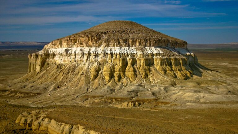
Aulietau Mountains, historical and cultural monuments (mazars of Zhoshy khan, Alasha khan, ancient cities of Baskamyr, Ayakkamyr, Terektiaulie rock paintings, etc.) are located in Ulytau.
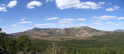
Karkaralinsky district is one of the centers of recreational tourism. There are 31 tourist sites and the main is Karkaralinsky State National Nature Park with a total area of 112.1 thousand hectares, of which 29.1 thousand hectares are intended for tourist and recreational activities (26% of the total area of the Park).
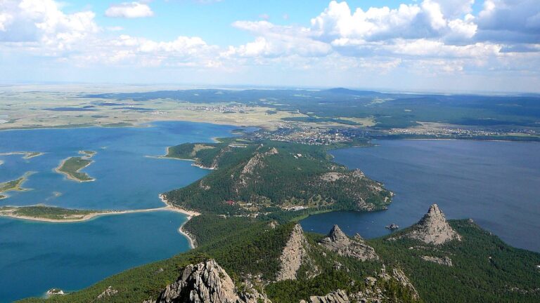
Lake Balkhash, Bektauata mountain range, Kyzylarai nature reserve, and Aksoran peak are the main tourism resources of the Balkhash resort area. At the moment, there are 57 accommodation facilities, and four areas for recreation – Bertys Bay in Balkhash town, Torangalyk and Shubar-Tubek villages and Priozersk town.
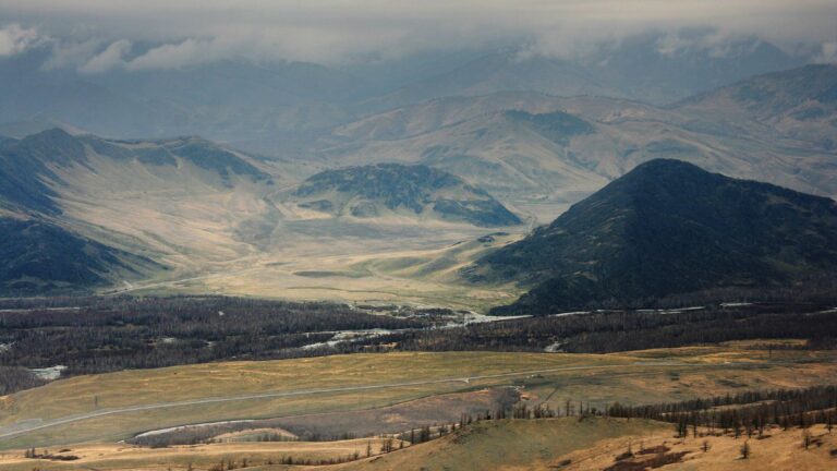
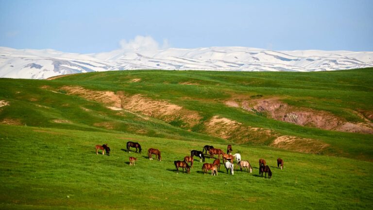
The Karaganda region spread freely and widely on the steppe expanses of Saryarka. The territory of the region occupies the most elevated central part of the Kazakhstan Upland. From the Karkaralinsk mountains in the east to Lake Tengiz in the west, from the Ishim River in the north to the Sherubai-Nurin reservoir in the south, there is a wide steppe, which the Kazakh people have given the poetic name of Saryarka since ancient times, which means “Yellow Ridge”.
The region itself was formed on March 10, 1932 as part of the Kazakh ASSR. Initially, its regional center was the city of Petropavlovsk. On July 29, 1936, the North Kazakhstan region was separated from it, consisting of 25 districts. Since August 3, 1936, the regional center has been located in Karaganda. Since December 5, 1936, the region was part of the Kazakh SSR. By the decree of the Presidium of the Supreme Soviet of the USSR of October 14, 1939, the city of Akmolinsk, as well as Akmola, Vishnevsky, Novocherkassk and Erkenshilik districts were transferred to the newly formed Akmola region. In 1973, its southern part was separated from the Karaganda region and the Dzhezkazgan (Zhezkazgan) region was formed. But in May 1997, the Zhezkazgan region was again annexed to the Karaganda region).
The territory of the region is 428 thousand square kilometers. The population of the region as of 2021 is 1 million 375 thousand people. According to the legend, in the 19th century subgenera Karak and Murat of the Altai-Karpyk clan of the Argyn tribe lived on the site of the city. And that in 1833 the shepherd boy Appak Baizhanov found coal. At the end of the 19th century, geological surveys were carried out, and at the beginning of the 20th century, coal mining began, first by Russian merchants, then by French and English entrepreneurs. On February 10, 1934, the city was named Karaganda.
There are festivals taking place in the region, such as:
Kokmaisa, celebration of the spring arrival, is held in a symbolic for the Kazakh people region, in the geographical and sacred center of the country, the place where the Kazakh zhuzes unite and the birth of Kazakh statehood. This place is at the foot of the Ulytau mountains.
Zhezkiik is an International Music Festival held annually in Ulytau.
DOSSTAR is an International Operetta and Musical Festival.
Since the city of Karaganda is the mining capital of the country (where there are large deposits of coal and most of the country’s coal is mined), the Miner’s Day is celebrated in the city on the last Sunday of August.
Karaganda region is the largest in terms of land area and industrial potential, rich in minerals and raw materials. The region occupies the most elevated part of the Kazakh Upland – Saryarka. The territory of the region within the new borders is 427 982 km² (15.7% of the total area of the territory of Kazakhstan). Almost a tenth of the total population of Kazakhstan lives in the region. In the north, it borders on the Akmola region, in the northeast – with Pavlodar, in the east – East Kazakhstan, in the southeast – Almaty, in the south – Zhambyl, Turkestan and Kyzylorda, in the west – Aktobe and in the north to the west – Kostanay.
There are 1910 lakes on the territory of the region, the largest is Balkhash, and the rivers of the region are mostly shallow.
The flora and fauna of the region is represented by a variety of plant species: wormwood, fescue, feather grass, yellow clover, thyme; acacia, meadowsweet, wild rose, feather grass, wormwood, animal – argali, roe deer, gazelles, wolves, foxes; birds – crane, golden eagle, kite, burial eagle, etc. Fish – crucian carp, tench, catfish, ide, grass carp, asp, bream, carp, pike perch, barbel, thorn
The climate is continental, winters are cold, in some years severe, with snowstorms. Average January temperatures are -16 – -17°С. Summers are hot, dry and windy. Average temperatures in July are 20-21°C. Annual precipitation in the north of the region is 250-300 mm, in the south – 150-210 mm, in low mountainous areas – 300-400 mm. It mostly rains from April to October.
Karaganda is the largest industrial region, a powerful industrial center, which occupies a leading position in Kazakhstan. The industry is represented by the mining and metallurgical complex. The food, pharmaceutical and chemical industries, light industry and the building materials industry were developed.
The region has significant reserves of 3 ferrous metals, 29 non-ferrous, 2 precious, 84 types of minerals, as well as energy carriers. So one of the largest companies in the region and the country as a whole are the Karaganda Coal Basin – the main supplier of coking coal for the enterprises of Kazakhstan. ArcelorMittal Temirtau JSC produces 100% pig iron and 90% steel in the republic. The chemical industry produces sulfuric acid, nitrogen fertilizers, explosives, etc. And the agricultural sector sows grain crops, potatoes, vegetables. Meat, milk, eggs and wool are produced.

