
Naryn is only accessible by road, with public transport connections to Issyk-Kul and Bishkek. Travel here is best done by private car or on horseback – but with 44,000 square miles to explore and less than 300,000 residents, it is best to plan for self-sufficiency.
A gravel mountain road connects to Kazarman and further into Jalalabad region; another travels through the remote Peak Dankova area to the far south of Issyk-Kul, and a paved highway connects with the Torugart border crossing and into China’s Xinjiang. From the town of Jumgal, a little-used gravel road continues to Kyzyl-Oi in Chuy region and onwards to the Suusamyr Valley.
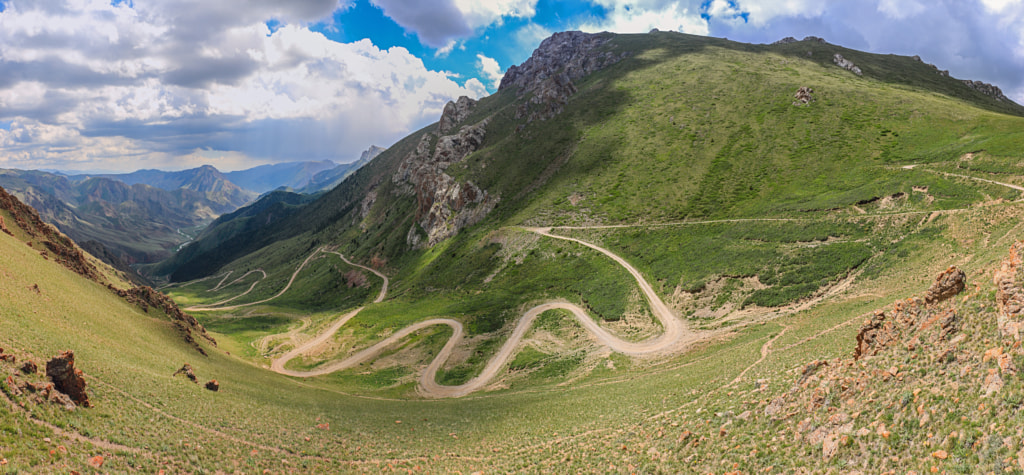
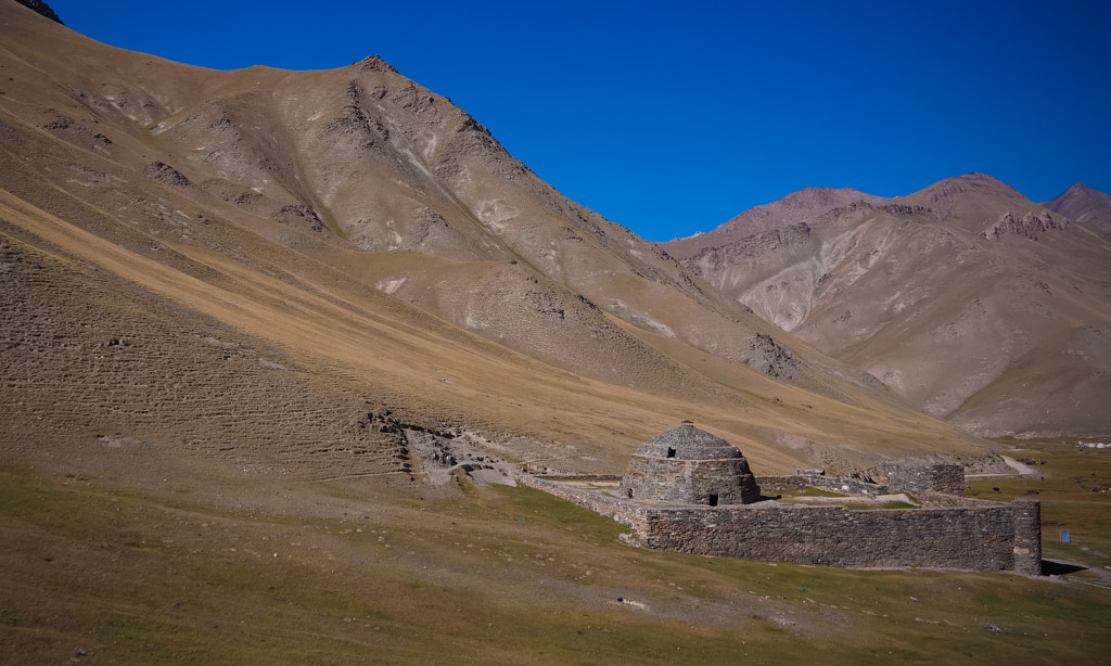
Tourism in Naryn is centred on the eponymous city and political centre, set in a dramatic canyon alongside the river of the same name. Tourists travel from here to the ruins of the 7th century Koshoi Korgon fortress and 15th century Tash Rabat Caravansaray, both remnants of the Silk Road trading paths that once linked the region to Europe and East Asia. Along the way, 400m-high Shaar Waterfall is visible from the highway or accessible by a four-hour ascent starting near At Bashi. Modern Silk Road travellers can continue to the Chinese border zone to Chatyr-Kol, Kyrgyzstan’s third-largest lake, and cross into Xinjiang.
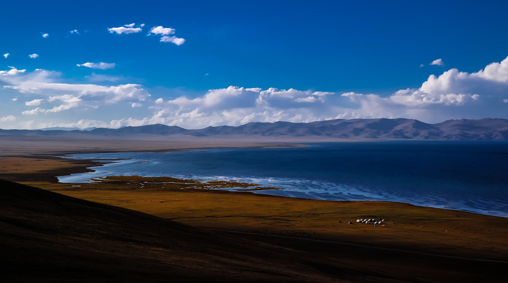
To the south of Naryn city, remote Kel Suu continues to grow in popularity among tourists looking for an offroad adventure to one of the Kyrgyz Republic’s most beautiful alpine lakes, while to the north the impressive Son Kol is a regular stop on tourist itineraries for horse trekking and yurt stays along the shore of the country’s second-largest lake.
Though quite close to Son Kol, the towns of Kochkor (and nearby Kol Ukok lake) and Jumgal (trailhead for numerous alpine lakes and caves held by legend to contain lost treasure) see very few visitors despite good transportation infrastructure.
The region has always been inhabited by nomadic Kyrgyz who moved to these places in the XI-XIII centuries, and to the present time make up 99% of the population. Naryn, like nowhere else, has preserved a nomadic way of life that has not changed for many centuries.
There are relatively few historical and cultural monuments on the territory of the region, as it has always been relatively remote from wars, trade routes, etc. Only in the Soviet period, settled communities and cities began to appear in the region, roads were built.
During the Soviet era, in order to preserve the amazing nature of this region intact and safe, most of the Naryn region was closed for tourism. Thanks to this, now the Naryn region is an ideal place for ecotourism and wild travel.
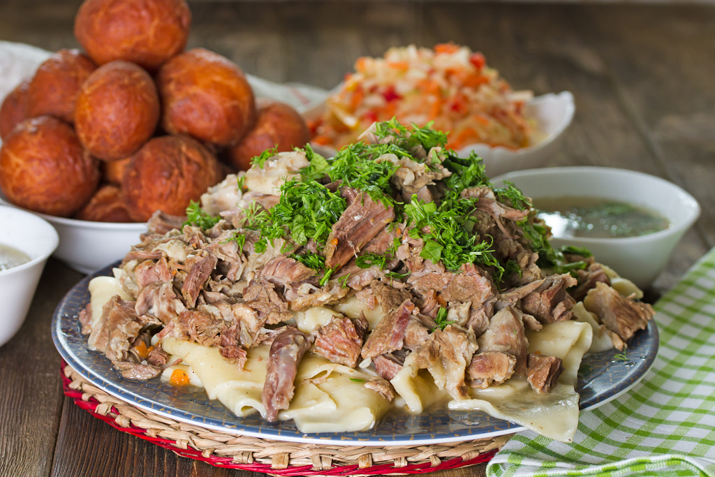
Naryn is synonymous in the Kyrgyz Republic with meat. Across the country beef, mutton and yak meat from Naryn command higher prices than any regional competitors, and menus advertise “Naryn” dishes to imply that their food is meatier and more delicious than elsewhere. Even the Kyrgyz culinary favourite beshbarmak is better in Naryn.
Gastronomy
Naryn beshbarmak is not a traditional beshbarmak, which is served, for example, in the north. The fact is that the Naryn region is rich in meat and poor in cereals. Therefore, 70 percent of the dish is meat, the rest is noodles. Some even cook the dish without the noodles, calling beshbarmak naaryn, which is made of finely chopped lamb meat (or horse meat) with onion sauce. A dish is served with traditional Kyrgyz horse meat delicacies – chuchuk and kazy karta.
Events
Community-Based Tourism’s Naryn office hosts several tourism events through the summer. Kochkor hosts the Kymyz Festival in June, in celebration of the country’s renowned fermented horse milk, while Naryn city celebrates local carpet makers with the Shyrdak Festival in June and traditional sports and culture at the Nukura Festival in September. In August, the town of At-Bashi hosts the Ethno Festival of Equestrian Games and Handicrafts.
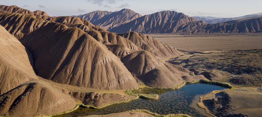
The Naryn region is the largest and most mountainous region of the country. More than 70% of the region’s territory is occupied by mountain ranges, among which Kokshaal-Too of Tien Shan, as well as the ridges of At-Bashy, Moldo-Too, Naryn-Too, Suusamyr-Too with the average height of 3000-4000 meters, are the largest. The ridges are separated by vast intermontane valleys, the most famous of which are the Ak-Say, Arpa and the Kochkor valleys.
The southern part of the Naryn region is the coldest place in Kyrgyzstan. The climate of the region is continental, winters are cold and long. The average January temperature is 15 ° C. The absolute minimum temperature (-50° C) was recorded in the Ak-Say valley.
Naryn Region also possesses most of the country’s water reserves. The high-mountain lakes Son-Kul, Kel-Suu and Chatyr-Kul are very popular. The largest river of the Tien Shan, the Naryn, has it source here.
The University of Central Asia’s Naryn campus brings an international-quality tertiary education to a mixture of local and international students in Naryn, and is a significant employer in the region, with over 80% of the campus’ jobs filled by local residents.
The economy is dominated by animal herding (sheep, horses, yaks), with wool and meat as the main products. Mining of various minerals developed during the Soviet era has largely been abandoned as uneconomical.
Today the Region is considered to be the poorest region in the country, but also the most typically Kyrgyz. It boasts beautiful mountains, alpine pastures and Son-Kul Lake which during summer months attracts large herds of sheep and horses with their herders and their yurts.


