
By plane: Tashkent-Termez-Tashkent – 3 times a week.
The schedule changes, so it is better to find out the departure hours during the booking
By bus: Tashkent-Termez-Tashkent -daily
By train: Tashkent-Termez-Tashkent – daily

Places to Visit
- Alexander Nevsky Orthodox Church
- Termez Zoo
- Regional Art Gallery
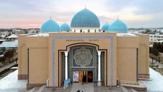
- Termez Archaeological Museum
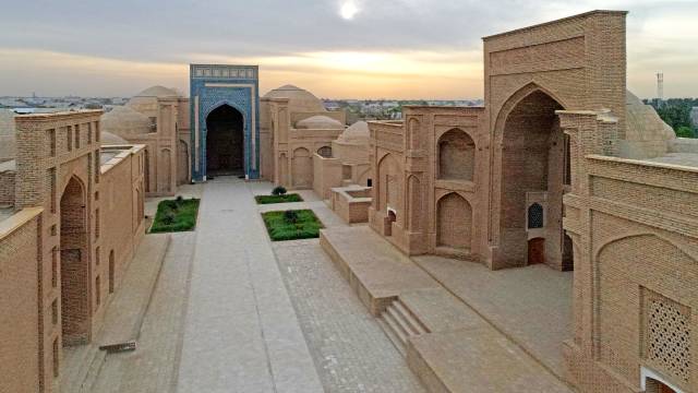
- Al Hakim at-Termizi complex
- KhanakaKokildorota
- Sultan Saodat Memorial Complex
- Kara-tepa and Fayaz-tepa Buddhist centers
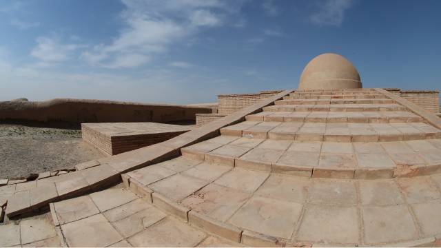
- Zurmala Buddhist Stupa
- KyrkKiz Fortress
- Abu Iso Termiziy Memorial Complex
- Zarautsoy Rock inscriptions
- Khozhaikon Salt Cave
- Khozhaimaykhon Natural landscape
- Millennial plane tree in Sairob
- KanbonTangisar
- Omonkhon Balneological Sanatorium
- Jarkurgan minaret
- Sangardak waterfall
- Places of pilgrimage: Khoja AlloudinAtor, Sufi Allayar, Ok ostona bobo, Mawlono Muhammad Zohid and more.
The administrative center of Surkhandarya is the ancient city of Termez. The city was founded in the 1st Millennium BC and is one of the oldest cities on the planet. The name of the city comes from “Taramastha” – which means ” a place on the other side “. The city received its perfect name only in the 10th century. Before that, he had many names: Demetrias, Antiachia, Tarmiz, Tarmid, Tamo, Tami.
Various fields of handicraft were developed in the city. Many goods made by the folk craftsmen of Termez were in great demand far beyond the city limits. In particular, in the countries of the East, Termez soap, haberdashery products and boats were very much appreciated. Medieval authors called Termez the economic and cultural center of northern Tokharistan. During this period, famous philisophers and poets in the Islamic world lived and worked in Termez. Among them are the scholar – Iso at-Termizi, the scholar-encyclopedist and thinker Hakim at-Termizi, the poet Sobir Termizi. At one time, it was Termez that was considered one of the main centers of Buddhism.
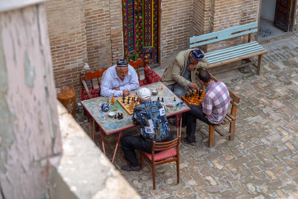
Not far from the city, archaeologists have found the oldest chess in the world, the figures of which were made of ivory. Here, with their troops, the most famous generals of the world passed: Alexander the Great, Genghis Khan, Amir Timur.
Many new administrative buildings and mosques were built in the city, and large-scale landscaping work was carried out.
By UNESCO decree, the city’s 2,500th anniversary was celebrated internationally.
The region is also known for its colorful festivals and exciting festivals that take place throughout the year. For example: Folk festivals “Navruz”, the traditional open festival “BoysunBahori”, the International Festival “Bakhshi” (Bakhshi International Art Festival in Termez) in Termez, Kupkari-folk equestrian competitions, the International Kurash Tournament named after Hakim at-Termezi.
Whatever the reason for your visit to Surkhandarya – to increase your pilgrimage knowledge ( of Muslims and Buddhism ), or to relax in the heart of nature-Surkhandarya has everything.
The climate of the flat part is characterized by warm winters and hot, dry and long summers. The average temperature in January is 2.8-3.6 °C, in July 28-32 °C. Precipitation falls on the plain from 130 to 360 mm per year, in the foothills and mountains from 445 to 625 mm.
The south of Surkhandarya region is characterized by dry winds and a south-westerly wind (Afghan). The frost-free period is from 226 to 266 days. High summer temperatures, a long frost-free period, provided irrigation, contribute to the maturation of thermophilic subtropical crops (fine-fiber cotton, eastern persimmon, etc.) and even sugar cane. Here you can observe all seasons, so in this oasis you can meet all kinds of flora and fauna.
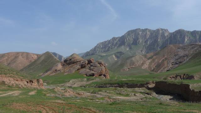
Every person who visits this region, first of all, will be delighted with its unique nature. The north-south landscape of the majestic Hissar Mountains, endless valleys and wide plains, the rich culture that has developed in different historical periods, add even more attractiveness and color to this region. Juniper, hazel, almond, poplar, pistachio tree and others grow in the mountains. They create a rich flora of these places. The main part of the vegetation cover of the plains is made up of various grasses, which cover the expanses with greenery in spring, and dry up in summer.
The central and southern parts of the region are flat, bordered on the north by the Hissar Ridge (southern slope, up to 4,643 m high), on the west and north-west by its spurs — the Baysuntau Mountains (up to 4,425 m) and Kugitangtau Mountains (up to 3,139 m), on the west by the Babatay Ridge (up to 2,290 m), on the south by the Amu Darya valley.
The main rivers are Surkhandarya with tributaries and Sherabad flowing from the surrounding mountains. The rivers have snow-glacial and snow-rain nutrition; for the most complete use of their water for irrigation, reservoirs have been built: Southern-Surkhan (with a volume of 800 million m3), Uchkyzyl, Degress; Sherabad, Amu-Zang, Jarkurgan hydroelectric power station channels; Zang, Khazarbag, and Kumkurgan channels were reconstructed.
The soils on the plain are light and typical gray — earth, in the floodplains of rivers — meadow and meadow-swamp; in the foothills and mountains — typical and dark gray-earth, sod-brown-earth and light-brown. The vegetation cover on the plain is dominated by ephemera. In the mountains, the vegetation is ephemeral-cereal, in high — altitude areas-subalp, tipchak-mixed grass; there are trees and shrubs-juniper, wild fruit, in the Babatag mountains, pistachio thickets.
In the valley of the Amu Darya istugai. In the mountains there are gazelle, mountain goat, wild boar, lynx, wolf, jackal, fox, brown bear, porcupine; among the birds-pheasant, keklik, larks. In the rivers — barbel, white amur, carp, asp. In 1964, the Aral-Paygambar Nature Reserve was established to protect the Bukhara deer (khongul), snakes (efa, viper, etc.).
Natural resources include petroleum, natural gas, and coal. Light industry, mainly cotton ginning and food processing, is also an important part of the regional economy, particularly in the production of consumer goods.
Agriculture is based primarily on cotton and cereals, supplemented with horticulture and viticulture. The climatic conditions of this region also make it possible to cultivate subtropical crops such as sugarcane.


